Services Provided
Planning
Client
Dept. of Public Works County of Kauai
Location
Kapaa, Kauai
Project Type – Markets
Recreation – Highways, Roads and Bridge
Kapaa-Kealia Bike Path Master Plan
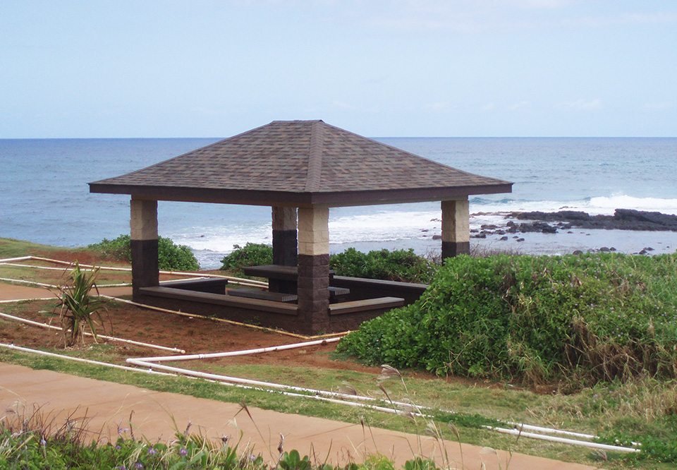
This Federally funded project involved the construction of a bike and pedestrian path along an approximately 3.0-mile shoreline from Kapaa Beach Park to Kanna Beach, before Ahihi Point.
SSFM was responsible for the overall project management of this project which included development of a master plan, Environmental Assessment, and discretionary land use permits. Master Plan development included inventory of shoreline conditions, conducting community workshops on the development of path alternatives, amenities, developing plans and perspective drawings for path and amenities.
More / Less
GIS data base and 3-D modeling of the route were available at the public informational meeting. The preparation and processing of the EA met both Federal and State requirements.
SSFM’s work also included conducting technical analysis, public and agency consultation, and report preparation and processing; conducting Section 106 consultation on the Island of Kauai which included consultation with Native Hawaiian organizations; consultation with the Kauai Island Burial Council, and the SHPD; compliance with other Federal regulations such as Section 7 consultation efforts with FWS, Executive Order (EO) 11988 on floodplains, EO 11990 for wetlands, and Coastal Zone Management Act; and, processing of discretionary land use permits such as a Conservation District Use Permit, Special Management Area Use Permit, and Shoreline Setback Variance. SSFM continues to provide planning assistance to various extensions of this path.

Kapaa-Kealia Bike Path Master Plan
This Federally funded project involved the construction of a bike and pedestrian path along an approximately 3.0-mile shoreline from Kapaa Beach Park to Kanna Beach, before Ahihi Point.
SSFM was responsible for the overall project management of this project which included development of a master plan, Environmental Assessment, and discretionary land use permits. Master Plan development included inventory of shoreline conditions, conducting community workshops on the development of path alternatives, amenities, developing plans and perspective drawings for path and amenities.
More / Less
GIS data base and 3-D modeling of the route were available at the public informational meeting. The preparation and processing of the EA met both Federal and State requirements.
SSFM’s work also included conducting technical analysis, public and agency consultation, and report preparation and processing; conducting Section 106 consultation on the Island of Kauai which included consultation with Native Hawaiian organizations; consultation with the Kauai Island Burial Council, and the SHPD; compliance with other Federal regulations such as Section 7 consultation efforts with FWS, Executive Order (EO) 11988 on floodplains, EO 11990 for wetlands, and Coastal Zone Management Act; and, processing of discretionary land use permits such as a Conservation District Use Permit, Special Management Area Use Permit, and Shoreline Setback Variance. SSFM continues to provide planning assistance to various extensions of this path.
Services Provided
Planning
Client
Dept. of Public Works County of Kauai
Location
Kapaa, Kauai
Project Type – Markets
Recreation – Highways, Roads and Bridge