Project Management
Structural Engineering
OWNER/CLIENT
Naval Facilities Engineering Command,
Hawaii, Pearl Harbor, Hawaii
LOCATION
Kaneohe, Hawaii
PROJECT TYPE/MARKET
Waterfront
Puuloa Shoreline Erosion Study
Puuloa Range Facility, Marine Corps Base Hawaii
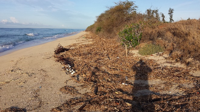
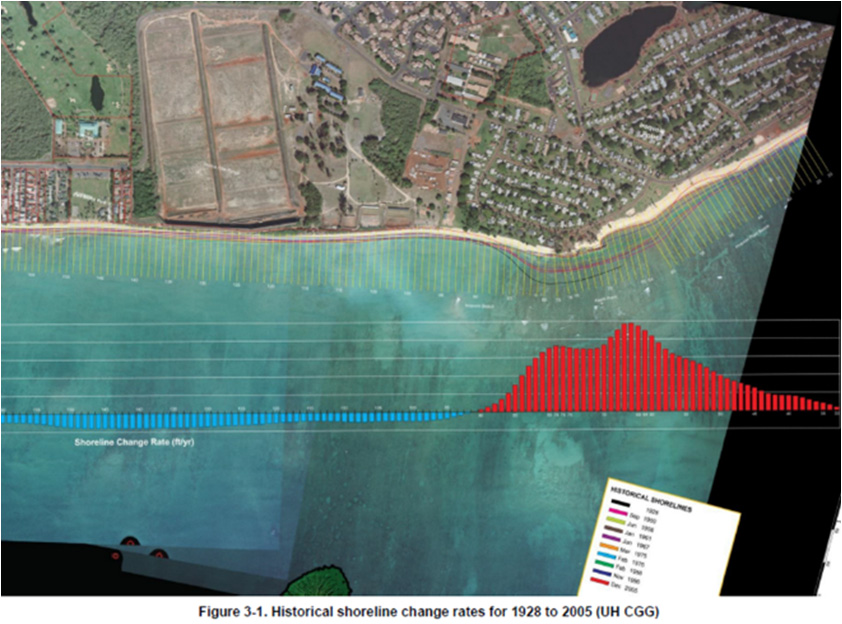
The Puuloa Shoreline Erosion Study investigated coastal processes and the condition and characteristics of the shoreline in the project area to determine historical changes, analyze wave induced sand transport mechanisms and develop erosion control alternatives.
The study included:
• A survey and photo documentation of the near shore benthic community to identify and spatially locate marine communities, habitats, features and structures that exist out to 500 yards.
• Understanding the ocean processes affecting sand migration/loss of beach, determining sand migration/movement patterns, and providing an analysis of shoreline change range, at the current rate of erosion, as to expectations for loss in the next 30, 40, and 50 years.
• Surveying and mapping the current shoreline to create a shoreline baseline of erosion as point of reference for determining rate of recovery. Results are provided in digital format consistent with MCBH GIS data layers.
• Determining the mean high and mean high water mark per ACOE regulations.
• Providing recommendations and cost estimates for varied engineering and environmental solutions to mitigate shoreline erosion and stabilize the Puuloa shoreline.
Puuloa Shoreline Erosion Study
Puuloa Range Facility, Marine Corps Base Hawaii
More / Less
• A survey and photo documentation of the near shore benthic community to identify and spatially locate marine communities, habitats, features and structures that exist out to 500 yards.
• Understanding the ocean processes affecting sand migration/loss of beach, determining sand migration/movement patterns, and providing an analysis of shoreline change range, at the current rate of erosion, as to expectations for loss in the next 30, 40, and 50 years.
• Surveying and mapping the current shoreline to create a shoreline baseline of erosion as point of reference for determining rate of recovery. Results are provided in digital format consistent with MCBH GIS data layers.
• Determining the mean high and mean high water mark per ACOE regulations.
• Providing recommendations and cost estimates for varied engineering and environmental solutions to mitigate shoreline erosion and stabilize the Puuloa shoreline.
Project Management
Structural Engineering
Client
Naval Facilities Engineering Command,
Hawaii, Pearl Harbor, Hawaii
Location
Kaneohe, Hawaii
Project Type – Markets
Waterfront